
Persistent Drought in the American West Challenges Existing Measurement Tools
Climate change in the American West is making droughts a regular occurrence. According to a new study, this shift challenges the efficacy of the U.S. Drought Monitor, a crucial tool used for assessing drought conditions across the country.
Since 1999, the U.S. Drought Monitor has published weekly maps indicating drought severity using five color-coded categories. Policymakers, federal agencies, and elected officials rely on these maps to make critical decisions regarding water use, campfire bans, and emergency declarations, as well as to allocate financial aid to farmers and ranchers.
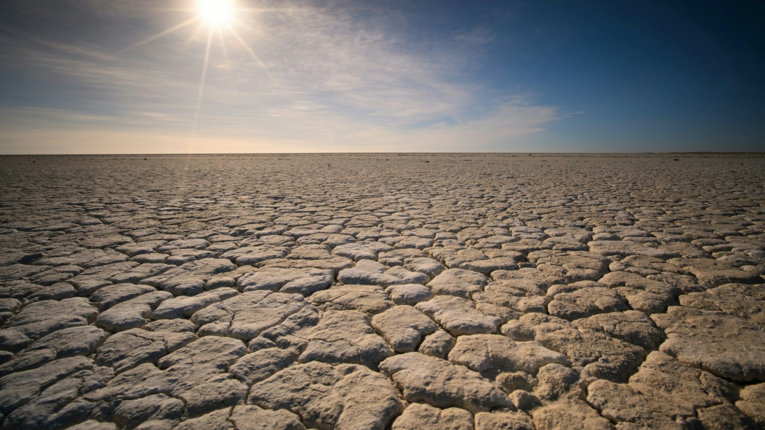
However, the study published in AGU Advances reveals that what was once considered an "exceptional drought" is becoming more common. According to the monitor’s guidelines, an exceptional drought should only occur 2% of the time in a region. Yet, some areas of the western U.S. have experienced exceptional drought conditions 18% of the time over the past two decades. Furthermore, these droughts are more severe than when the monitor was first established.
Justin Mankin, a professor at Dartmouth College and the study’s lead author, questions the utility of a drought map that frequently shows extreme conditions. "What is the value to a decision-maker of a map that is just red all of the time?" Mankin said. "It doesn’t help you triage resources."
The implications of this persistent drought are significant for Colorado’s $47 billion agriculture industry, per The Denver Post. The state frequently experiences drought conditions, and brief periods of relief from dryness have become notable events, such as in 2023 when the state was declared drought-free for the first time since 2019. However, drought has since returned, with nearly half of Colorado now facing drought or near-drought conditions.
Mankin and his colleagues explored two potential solutions to better incorporate climate change into drought monitoring, though both have limitations. One option is to create a new drought category beyond "exceptional drought," similar to proposals for a new Category 6 for increasingly severe hurricanes. Another approach is to adjust the baseline data for the Drought Monitor to reflect more recent, drier years.
The U.S. Department of Agriculture updated its plant hardiness map last year to include more recent climate data, guiding farmers and gardeners on planting decisions based on their locations. A similar update to the Drought Monitor could obscure the impacts of climate change and downplay the severity of aridification, Mankin warned.
The U.S. Drought Monitor’s most recent summary points out that this week saw significant changes in the tool’s depiction of dryness and drought, particularly across the contiguous U.S. east of the Mississippi River. In southern Florida for instance, the entrenched moderate to severe drought (D1 to D2) was “literally washed away” by inundating tropical rains.
The organization added:
"The opposite was the case farther north across most of the Eastern States. Rainfall has been generally below-normal across a majority of this region for the past 1 to 2 months, with subnormal rainfall dating back 3 or more months in some areas. Increasingly, above-normal temperatures have accompanied the dryness, which has added to the rate of surface moisture depletion. Temperatures have had the greatest impact on conditions in the climatologically-hotter areas across the South until late this past week, when excessive heat started to engulf the Great Lakes and Northeast. Declining streamflows and dropping soil moisture started to become obviously apparent this past week over large sections of the East, and as a result, there was an expansive increase in new D0 coverage east of the Mississippi River and north of central Florida, with only small spots in Georgia and Maine experiencing any discernable relief. Farther west, although changes were not as expansive, both south-central and north-central portions of the Plains and Rockies also saw significant areas where dry conditions developed or intensified. There were other areas of heavy rain outside southern Florida, but most of it fell on sections of the Upper Midwest that have received consistently above-normal precipitation for at least several weeks, thus bringing no changes to areas of dryness and drought. West of the Mississippi River, limited improvement was introduced in relatively small swaths in northeastern Arkansas, central and western Kansas, southern Nebraska, southwestern Montana, and a few adjacent locales.”
As climate change continues to alter weather patterns and exacerbate drought conditions, the need for updated and accurate drought monitoring tools becomes increasingly critical—and journalists must step up.